DAMS IN WASHIM DISTRICT - PART TWO. (EDITED)
All 33 blogs covering 380 dams in 11 Districts of Vidarbha Region were edited between Aug & Sept 2020. For details go to blog "Vidarbha Region. Edit-Now - Why". Link here.
There are total of 53 Major Dams ( Height from foundation 10 meters or more ) in Washim District.
Information on these parts is covered in Five Parts.
Part One. 1.Zodga. 2.Adan. 3.Gartek. 4.Chousala. 5. hanora Bhuse. 6.Mohari.
7. Bramhanwada 1. 8. Bramhanwada 2. 9.Pimpari (Kd). 10.Ridhora. 11.Sukhanda/Sukanda.
Part Two. 12.Sonkhas. 13. Rohana. 14.Asola. 15.Wathod. 16.Borwa. 17.Karli.
18.Borala. 19.Mungala. 20.Kalmeshwar. 21.Motsawanga. 22.Kolambi. 23.Gid.
Part Three. 24.Masala Kd. 25.Sawanga. 26.Giroli. 27.Chikhali. 28.Sawargaon. 29.Koyali.
30.Sonala/Sonal. 31.Asegaonbandh. 32.Asolagavha. 33.Panchala. 34.Amdari. 35.Waigoul.
Part Four. 36.Gondala/Gaundhala. 37.Ratanwadi. 38.Rui. 39.Fulmari. 40.Umra Sm. 41. Adol. 42.Waghi.43.Dhodho. 44.Ekburji. 45.Dhumka. 46.Shirputi.
Part Five. 47.Warala. 48.Ansing. 49.Karada. 50.Ganeshpur. 51.Pachamba. 52.Mandwa.
53.Jawala.
12.Sonkhas. ( Latitude : 20.2868139N, Longitude : 77.324717E )

Map & link uploaded Aug - Sept 2020.
For viewing the surrounding areas and map page click here.
Some information about Sonkhas Irrigation Project.
Sonkhas. Project and Dam's Official Designation is "Sonkhas., D - 0 4867" . Locally also known as " Sonkhas. Lake" / " Sonkhas. Talav" . Sonkhas. Dam was constructed as part of irrigation projects by Government of Maharashtra in the year .1975 . Nearest city to dam is Mangrul Pir and the Dam is situated in Mangrul Pir Taluka of Washim District of Maharashtra . It is built on and impounds Khanday River . The dam is an Earth-fill Gravity Dam . Purpose of the dam is for irrigation . The length of the dam is 330 m ( 1082.68 Feet ) while the height of the dam above lowest foundation is 17.5 m ( 57.41Feet ) . Detailed information about project spillway is not available . At least today there are no traces of a proper spillway . Dam's catchment area is not known . Maximum / Gross storage capacity is 1.44 MCM . Live storage capacity is 1.359 MCM. These storage figures may not hold good at all as on date, 30 Decemner 2012, there is no proper spillway as big part of the dam and Spillway has been washed away. affecting the storage
Now a days almost all the water bodies make for good picnic spots . Sonkhas. lake is also a popular Tourist attraction for its scenic beauty .
(Note : Blue area in normal map corresponds to Maximum / Full Reservoir Levels. )
Now a days almost all the water bodies make for good picnic spots . Sonkhas. lake is also a popular Tourist attraction for its scenic beauty .
(Note : Blue area in normal map corresponds to Maximum / Full Reservoir Levels. )
13. Rohana. ( Latitude : 20.2755627N, Longitude : 77.4766588E )

Map & link uploaded Aug - Sept 2020.
For viewing the surrounding areas and map page click here.
Some information about Rohana Irrigation Project.
Rohana Project and Dam's Official Designation is "Rohana , D - 0 4717" . Locally also known as " Rohana Lake" / " Rohana Talav" . Rohana Dam was constructed as part of irrigation projects by Government of Maharashtra in the year 1974. Nearest city to dam is Manora and the Dam is situated in Manora Taluka of Washim District of Maharashtra . It is built on and impounds a local Nallah . The dam is an Earth-fill Gravity Dam .Purpose of the dam is for irrigation . The length of the dam is 275 m ( 902.23 Feet ) while the height of the dam above lowest foundation is 18.32 m ( 51.50 Feet ) . Detailed information about project spillway is not available . However , The Project appears to have a Spillway of Other type . Length of the spillway is not known . However measured length of the spillway is approximately 89 m ( 294 Feet ).The Spillway is Ungated . Dam's catchment area is not known . Maximum / Gross storage capacity is 2.91 MCM . Live storage capacity is 2.79 MCM. Now a days almost all the water bodies make for good picnic spots . Rohana lake is also a popular Tourist attraction for its scenic beauty .
(Note : Blue area in normal map corresponds to Maximum / Full Reservoir Levels. )
(Note : Blue area in normal map corresponds to Maximum / Full Reservoir Levels. )
14.Asola. ( Latitude : 20.2783152N, Longitude : 77.5270844E )

Map & link uploaded Aug - Sept 2020.
For viewing the surrounding areas and map page click here.
Some information about Asola Irrigation Project.
Asola Project and Dam's Official Designation is "Asola , D - 0 3336" . Locally also known as " Asola Lake" / " Asola Talav" . Asola Dam was constructed as part of irrigation projects by Government of Maharashtra in the year 1976 . Nearest city to dam is Manora and the Dam is situated in Manora Taluka of Washim District of Maharashtra . It is built on and impounds a local Nallah . The dam is an Earth-fill Gravity Dam .Purpose of the dam is for irrigation . The length of the dam is 2959 m ( 9708.00 Feet ) while the height of the dam above lowest foundation is 18 m ( 59.05 Feet ) . Detailed information about project spillway is not available However , The dam does not have a proper spillway at all . At least whatever is left of what was once a Spillway , is in a very bad condition being eroded and partly washed away.
Length of the spillway is not known . The Spillway is Ungated . Dam's catchment area is not known . Maximum / Gross storage capacity is 3.56 MCM . Live storage capacity is 3.31 MCM. Now a days almost all the water bodies make for good picnic spots . Asola lake is also a popular Tourist attraction for its scenic beauty .
( Note : Reservoir polygon corresponds to maximum / full water levels. )
At india-wris.nrsc.gov.in/wrpinfo/index.php?title=Asola_D0... Length of the Dam is given as 2959 m . Appears wrong measured is approximatly 300 m.
(Note : Blue area in normal map corresponds to Maximum / Full Reservoir Levels. )
15.Wathod. ( Latitude : 20.2582919N, Longitude : 77.5690985E )

Map & link uploaded Aug - Sept 2020.
For viewing the surrounding areas and map page click here.
Some information about Wathod Irrigation Project.
Wathod Project and Dam's Official Designation is "Wathod , D - 0 5074" . Locally also known as " Wathod Lake" / " Wathod Talav" . Wathod Dam was constructed as part of irrigation projects by Government of Maharashtra in the year 1974 . Nearest city to dam is Manora and the Dam is situated in Manora Taluka of Washim District of Maharashtra . It is built on and impounds a local Nallah . The dam is an Earth-fill Gravity Dam .Purpose of the dam is for irrigation . The length of the dam is 290 m ( 951.44 Feet ) while the height of the dam above lowest foundation is 16.6 m ( 54.46 Feet ) . Detailed information about project spillway is not available . However , spillway in a state of dis repair does exists..Spillway appears to be of Other type . Length of the spillway is not known . However measured length of the spillway is approximately 39 m ( 127 Feet )........ The Spillway is Ungated . Dam's catchment area is not known . Maximum / Gross storage capacity is 1.98 MCM . Live storage capacity is 1.9 MCM. Now a days almost all the water bodies make for good picnic spots . Wathod lake is also a popular Tourist attraction for its scenic beauty .
(Note : Blue area in normal map corresponds to Maximum / Full Reservoir Levels. )
(Note : Blue area in normal map corresponds to Maximum / Full Reservoir Levels. )
16.Borwa. ( Latitude : 20.2505516N, Longitude : 77.6184726E )

Map & link uploaded Aug - Sept 2020.
For viewing the surrounding areas and map page click here.
Some information about Borwa Irrigation Project.
Borwa Project and Dam's Official Designation is "Borwa , D - 0 3502" . Locally also known as " Borwa Lake" / " Borwa Talav" . Borwa Dam was constructed as part of irrigation projects by Government of Maharashtra in the year 1975 . Nearest city to dam is Manora and the Dam is situated in Manora Taluka of Washim District of Maharashtra . It is built on and impounds a local Nallah . The dam is an Earth-fill Gravity Dam .Purpose of the dam is for irrigation . The length of the dam is 305 m ( 1000.66 Feet ) while the height of the dam above lowest foundation is 15.6 m (51.18Feet ) . Detailed information about project spillway is not available However , Project appears to have a Spillway of Other type . Length of the spillway is not known . However measured length of the spillway is approximately 40 m ( 130 Feet ). The Spillway is Ungated . Dam's catchment area is not known . Maximum / Gross storage capacity is 1.107 MCM . Live storage capacity is 0.988 MCM. Now a days almost all the water bodies make for good picnic spots . Borwa lake is also a popular Tourist attraction for its scenic beauty .
(Note : Blue area in normal map corresponds to Maximum / Full Reservoir Levels. )
(Note : Blue area in normal map corresponds to Maximum / Full Reservoir Levels. )
17.Karli. ( Latitude : 20.2441396N, Longitude : 77.6260042E )

Map & link uploaded Aug - Sept 2020.
For viewing the surrounding areas and map page click here
Karli Project and Dam's Official Designation is "Karli , D - 0 4078" . Locally also known as " Karli Lake" / " Karli Talav" . Karli Dam was constructed as part of irrigation projects by Government of Maharashtra in the year 1990 . Nearest city to dam is Manora and the Dam is situated in Manora Taluka of Washim District of Maharashtra . It is built on and impounds a local Nallah . The dam is an Earth-fill Gravity Dam .Purpose of the dam is for irrigation . The length of the dam is 292 m ( 958.00 Feet ) while the height of the dam above lowest foundation is 14.8 m (48.55 Feet ) . Detailed information about project spillway is not available However , Project appears to have a Spillway of Other type . Length of the spillway is not known . However measured length of the spillway is approximately 38 m ( 125 Feet ) .The Spillway is Ungated . Dam's catchment area is not known . Maximum / Gross storage capacity is 1.035 MCM . Live storage capacity is 0.987 MCM. Now a days almost all the water bodies make for good picnic spots . Karli lake is also a popular Tourist attraction for its scenic beauty .
(Note : Blue area in normal map corresponds to Maximum / Full Reservoir Levels. )
(Note : Blue area in normal map corresponds to Maximum / Full Reservoir Levels. )
18.Borala. ( Latitude : 20.2696148N, Longitude : 77.1524119E )

Map & link uploaded Aug - Sept 2020.
For viewing the surrounding areas and map page click here.
Some information about Borala Irrigation Project.
Borala Project and Dam's Official Designation is "Borala , D - 0 3484" . Locally also known as " Borala Lake" / " Borala Talav" . Borala Dam was constructed as part of irrigation projects by Government of Maharashtra in the year 1970 . Nearest city to dam is Washim and the Dam is situated in Malegaon Taluka of Washim District of Maharashtra . It is built on and impounds a local Nallah . The dam is an Earth-fill Gravity Dam .Purpose of the dam is for irrigation . The length of the dam is 385 m ( 1263.12 Feet ) while the height of the dam above lowest foundation is 17.12 m ( 56.16 Feet ) . Detailed information about project spillway is not available However , Project appears to have a Spillway of Other type . Length of the spillway is not known . The Spillway is Ungated . Dam's catchment area is not known . Maximum / Gross storage capacity is 2.2 MCM . Live storage capacity is 1.86 MCM. Now a days almost all the water bodies make for good picnic spots . Borala lake is also a popular Tourist attraction for its scenic beauty .
(Note : Blue area in normal map corresponds to Maximum / Full Reservoir Levels. )
(Note : Blue area in normal map corresponds to Maximum / Full Reservoir Levels. )
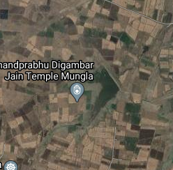
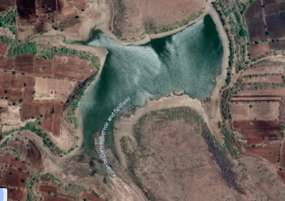
Map & link uploaded Aug - Sept 2020.
For viewing the surrounding areas and map page click here.
Some information about Mungala. Irrigation Project.
Mungala Project and Dam's Official Designation is "Mungala , D - 0 4395" . Locally also known as " Mungala Lake" / " Mungala Talav" . Mungala Dam was constructed as part of irrigation projects by Government of Maharashtra the year of construction is not known.. Nearest city to dam is Risod and the Dam is situated in Malegaon Taluka of Washim District of Maharashtra . It is built on and impounds a local Nallah . The dam is an Earth-fill Gravity Dam .Purpose of the dam is for irrigation . The length of the dam is 854 m ( 2801.84 Feet ) while the height of the dam above lowest foundation is 12.4 m ( 40.68 Feet ) . Detailed information about project spillway is not available . However , Project appears to have a Spillway of Other type . Length of the spillway is not known . However measured length of the spillway is approximately 194 m ( 367 Feet ) The Spillway is Ungated . Dam's catchment area is not known . Maximum / Gross storage capacity is 2.06 MCM . Live storage capacity is 1.86 MCM. Now a days almost all the water bodies make for good picnic spots .Mungala lake is also a popular Tourist attraction for its scenic beauty .
(Note : Blue area in normal map corresponds to Maximum / Full Reservoir Levels. )
(Note : Blue area in normal map corresponds to Maximum / Full Reservoir Levels. )

Map & link uploaded Aug - Sept 2020.
For viewing the surrounding areas and map page click here.
Some information about Kalmeshwar Irrigation Project.
There are two dams with the name Kalmeshwar in Maharashtra. 1. Near Mehkar in Buldhana District and 2. Near Male Gaon in Washim District.
Kalmeshwar Project and Dam's Official Designation is "Kalmeshwar , D - 0 4040" . Locally also known as " Kalmeshwar Lake" / " Kalmeshwar Talav" . Kalmeshwar Dam was constructed as part of irrigation projects by Government of Maharashtra in the year 1995 . Nearest city to dam is Malegaon and the Dam is situated in Malegaon Taluka of Washim District of Maharashtra . It is built on and impounds Morna River ,. The dam is an Earth-fill Gravity Dam .Purpose of the dam is for irrigation . The length of the dam is 1440 m ( 4724.40 Feet ) while the height of the dam above lowest foundation is 17.82 m ( 58.46 Feet ) . Detailed information about project spillway is not available . However , Project appears to have a Spillway of Other type . Length of the spillway is not known . However measured length of the spillway is approximately 127 m ( 415 Feet ). The Spillway is Ungated . Dam's catchment area is not known . Maximum / Gross storage capacity is 5.22 MCM . Live storage capacity is 4.72 MCM. Now a days almost all the water bodies make for good picnic spots .Kalmeshwar lake is also a popular Tourist attraction for its scenic beauty .
(Note : Blue area in normal map corresponds to Maximum / Full Reservoir Levels. )

Map & link uploaded Aug - Sept 2020.
For viewing the surrounding areas and map page click here.
Some information about Motsawanga Irrigation Project.
Motsawanga Project and Dam's Official Designation is "Motsawanga , D - 01293" . Locally also known as " Motsawanga Lake" / "Motsawanga Talav" . Motsawanga Dam was constructed as part of irrigation projects by Government of Maharashtra in the year1975 . Nearest city to dam is Mngrul Pir and the Dam is situated in Mngrul Pir Taluka of Washim District of Maharashtra . It is built on and impounds Madan River . The dam is an Earth-fill Gravity Dam .Purpose of the dam is for irrigation . The length of the dam is 1498 m ( 4914.69 Feet ) while the height of the dam above lowest foundation is 21 m ( 68.89 Feet ) . Detailed information about project spillway is not available . However . Project appears to have a Spillway of Other type . Length of the spillway is not known . However measured length of the spillway isapproximately 127 m ( 417 Feet ) The Spillway is Ungated Dam's catchment area is not known . Maximum / Gross storage capacity is 4.68 MCM . Live storage capacity is 3.84 MCM. Now a days almost all the water bodies make for good picnic spots .Motsawanga lake is also a popular Tourist attraction for its scenic beauty .
(Note : Blue area in normal map corresponds to Maximum / Full Reservoir Levels. )
(Note : Blue area in normal map corresponds to Maximum / Full Reservoir Levels. )
22.Kolambi. ( Latitude : 20.244434,N, Longitude : 77.354731 )
Map & link uploaded Aug - Sept 2020.
For viewing the surrounding areas and map page click here.
Some information about Kolambi Irrigation Project
Kolambi Project and Dam's Official Designation is "Kolambi , D - 01293" . Locally also known as " Kolambi Lake" / "Kolambi Talav" . Kolambi Dam was constructed as part of irrigation projects by Government of Maharashtra in the year 1995 . Nearest city to dam is Mangrul Pir and the Dam is situated in Mangrul Pir Taluka of Washim District of Maharashtra . It is built on and impounds a local Nallah . The dam is an Earth-fill Gravity Dam .Purpose of the dam is for irrigation. The length of the dam is 309 m ( 1013.78 Feet ) while the height of the dam above lowest foundation is 19.6 m ( 64.30 Feet ) . Detailed information about project spillway is not available . However , Project appears to have a Spillway of Other type . Length of the spillway is not known . However measured length of the spillway is approximately 37 m ( 122 Feet ). The Spillway is Ungated . Dam's catchment area is not known . Maximum / Gross storage capacity is 1.589 MCM . Live storage capacity is 1.5 MCM. Now a days almost all the water bodies make for good picnic spots .Kolambi lake is also a popular Tourist attraction for its scenic beauty .
(Note : Blue area in normal map corresponds to Maximum / Full Reservoir Levels. )
(Note : Blue area in normal map corresponds to Maximum / Full Reservoir Levels. )

Map & link uploaded Aug - Sept 2020.
For viewing the surrounding areas and map page click here.
Some information about Gid Irrigation Project.
Gid Project and Dam's Official Designation is "Gid , D - 0 3875" . Locally also known as " Gid Lake" / "Gid Talav" . Gid Dam was constructed as part of irrigation projects by Government of Maharashtra in the year 1984 . Nearest city to dam is Manora and the Dam is situated in Mangrul Pir Taluka of Washim District of Maharashtra . It is built on and impounds a local Nallah . The dam is an Earth-fill Gravity Dam .Purpose of the dam is for irrigation . The length of the dam is 420 m ( 1377.95 Feet ) while the height of the dam above lowest foundation is 16 m ( 52.49 Feet ) . Detailed information about project spillway is not available . What is left of what was once a Spillway , is in a bad condition being eroded and partly washed away. Length of the spillway is not known . The Spillway is Ungated . Dam's catchment area is not known . Maximum / Gross storage capacity is 1.5 MCM . Live storage capacity is 1.34 MCM. Now a days almost all the water bodies make for good picnic spots .Gid lake is also a popular Tourist attraction for its scenic beauty .
( Note : Reservoir polygon corresponds to maximum / full water levels. )
( Note : Reservoir polygon corresponds to maximum / full water levels. )
No comments:
Post a Comment