DAMS IN GONDIA DISTRICT. PART TWO.
All 33 blogs covering 380 dams in 11 Districts of Vidarbha Region were edited between Aug & Sept 2020. For details go to blog "Vidarbha Region. Edit-Now - Why". Link here.
There are total of 23 Major Dams ( Height from foundation 10 meters or more ) in Gondia District.
Information on these dams is covered in Two Parts.
One. 1.Kalimatitola. 2.Serpur. 3.Risala. 4.Katangi. 5.Managad. 6.Bodalkasa. 7.Bewartola. 8.Pangadi.9.Sangrampur. 10.Khairbandha. 11.Chorkhamara. 12.Rengepar.Part Two. 13.Pujaritola. 14.Kalisarar. 15.Umarzari. 16.Salegaon. 17.Sirpur. 18.Salebardi.
19.Navegaonbandh. 20.Itiadoh. 21.Palandar Zamindari. 22.Rajoki. 23.Chulbandh.
13.Pujaritola. ( LATITUDE : 21.2372224N, LONGITUDE : 80.4338264E )
13.Pujaritola. ( LATITUDE : 21.2372224N, LONGITUDE : 80.4338264E )

Map & link uploaded Aug- Sept 2020.
For viewing the surrounding areas and the map page click HERE.
Some information about Pujaritola Irrigation ProjectOfficial Designation of Pujaritola Dam Irrigation Project is "Pujaritola Dam , D - 01384 " . However local and popular name is " Pujaritola Lake / Pujaritola Talav "
Pujaritola Dam was constructed as part of an irrigation project by Maharashtra Government in 1970 on Bagh river near Amgaon in Gondia District of Maharashtra . The dam is an earth fill and gravity dam .The height of the dam above lowest foundation is 19.2 m (63 ft) while the length of dam is 2,661 m (8,730 ft). Project has a Spillway of Ogee type.Length of the spillway is 187.76 m (286.9265 feet), Spillway consists of 13 radial type of spillway gates.It has catchment area of 69.93 thousand hectors. Maximum storage capacity is 65.11 MCM. Live storage capacity is 48.69 MCM. A good picnic spot,
(Note : Blue area in normal map corresponds to Maximum / Full Reservoir Level.)
14.Kalisarar. ( LATITUDE : 21.1768487N, LONGITUDE : 80.4540825E )
14.Kalisarar. ( LATITUDE : 21.1768487N, LONGITUDE : 80.4540825E )

Map & link uploaded Aug- Sept 2020.
For viewing the surrounding areas and the map page click HERE.
Some information about Kalisarar Irrigation ProjectKalisrar Project was approved by Planning Commission Of India as a Major Inter State Irrigation Project between the states of Maharashtra and Madhya Pradesh in year 1977.It was completed in 1988.Project has two components one , Kalisrar Project (MP Portion) and The other Kalisrar Maharashtra Project . In this description only Maharashtra part is covered.
Kalisrar Dam constructed as part of an inter state irrigation project on Bagh / Wainganga river near Salekasa in Gondia District of Maharashtra . Official Designation of Kalisrar Dam Irrigation Project is "Kalisrar Dam , D - 01115 " . The dam is an Earth and Masonary dam .) The length of dam is 830 m ( 2723 ft) while the height of the dam above lowest foundation is 25.52 m ( 84 ft Project has a Spillway of Ogee type.Length of the spillway is 57.35 m ( 188 feet), Spillway consists of 4 radial type of spillway gates.It has catchment area of 13.1 thousand hectors. Maximum storage capacity is30.46 MCM. Live storage capacity is 27.75 MCM. A good picnic spot,
(Note : Blue area in normal map corresponds to Maximum / Full Reservoir Level.)
15.Umarzari. ( LATITUDE : 21.1623017N, LONGITUDE : 80.2611136E )
15.Umarzari. ( LATITUDE : 21.1623017N, LONGITUDE : 80.2611136E )

Map & link uploaded Aug- Sept 2020.
For viewing the surrounding areas and the map page click HERE.
Some information about Umarzari Irrigation ProjectOfficial Designation of Umarzari Dam Irrigation Project is "Umarzari Dam , D - 01115 ". However local and popular name is " Umarzari Talav / Umarzari Lake " .Umarzari Medium Irrigation Project is constructed as part of irrigation projects by the Government Maharashtra.It was completed in 1998 .Umarzari Dam was constructed on Umarzari River near Gondia in Gondia District of Maharashtra . The dam is an Earth fill dam . The length of dam is 1997 m ( 6552 ft ) while the height of the dam above lowest foundation is 18.5 m ( 61 ft ) .Project has a Spillway of Ogee/other type.Length of the spillway is 22.08 m ( 72.44 feet ), Informatuon on spillways is not available.It has catchment area of 5.594 thousand hectors. Maximum / Gross storage capacity is 6.102 MCM. Live storage capacity is 5.522 MCM. Now a days almost all the water bodies make for good picnic spots.
(Note : Blue area in normal map corresponds to Maximum / Full Reservoir Level.)
16.Salegaon. ( LATITUDE : 21.152236N, LONGITUDE : 80.336194E )

Information about Salegaon Irrigation Project.
Official Designation of Umarzari Dam Irrigation Project is "Umarzari Dam , D - 01115 ". However local and popular name is " Umarzari Talav / Umarzari Lake ."Salegaon Irrigation Project is constructed as part of irrigation projects in 1964 by the Government Maharashtra. It is built on a Local Nallah near city of Deori in Gondia District of Maharashtra . The dam is an Earth fill dam .The length of dam is178 m ( 583.99 ft ) , while the height of the dam above lowest foundation is 17.27 m ( 56.6601 feet ) . Project has a no proper Spillway of any type.Length of the spillway is Not known, spillway is un-gated.Its has catchment area is not known of 6.01 thousand hectors. Maximum / Gross storage capacity is 3.395 MCM. Live storage capacity is 3.364 MCM. Now a days almost all the water bodies make for good picnic spots.Being in Nagzira Wild Life Sanctuary is tourist spot and place of wild life safaris.
16.Salegaon. ( LATITUDE : 21.152236N, LONGITUDE : 80.336194E )
Map & link uploaded Aug- Sept 2020.
For viewing the surrounding areas and the map page click HERE.
Some information about Salegaon Irrigation ProjectInformation about Salegaon Irrigation Project.
Official Designation of Umarzari Dam Irrigation Project is "Umarzari Dam , D - 01115 ". However local and popular name is " Umarzari Talav / Umarzari Lake ."Salegaon Irrigation Project is constructed as part of irrigation projects in 1964 by the Government Maharashtra. It is built on a Local Nallah near city of Deori in Gondia District of Maharashtra . The dam is an Earth fill dam .The length of dam is178 m ( 583.99 ft ) , while the height of the dam above lowest foundation is 17.27 m ( 56.6601 feet ) . Project has a no proper Spillway of any type.Length of the spillway is Not known, spillway is un-gated.Its has catchment area is not known of 6.01 thousand hectors. Maximum / Gross storage capacity is 3.395 MCM. Live storage capacity is 3.364 MCM. Now a days almost all the water bodies make for good picnic spots.Being in Nagzira Wild Life Sanctuary is tourist spot and place of wild life safaris.
(Note : Blue area in normal map corresponds to Maximum / Full Reservoir Level.)
17.Sirpur. ( LATITUDE : 21.0571087N, LONGITUDE : 80.4539967E )
17.Sirpur. ( LATITUDE : 21.0571087N, LONGITUDE : 80.4539967E )

Map & link uploaded Aug- Sept 2020.
For viewing the surrounding areas and the map page click HERE.
Some information about sirpur Irrigation ProjectInformation about Sirpur Medium Irrigation Project.
Official Designation of Sirpu Dam Irrigation Project is "Sirpui Dam , D - 01039 ". However local and popular name is "SirpuTalav / Sirpu Lake Sirpur Medium Irrigation Project is constructed as part of irrigation projects by the State Government of Maharashtra.It was completed in 1970. Sirpur Dam is built on Bagh River near Deori in Gondia District of Maharashtra . The dam is an Earth and Masonary dam . The length of dam is 2840 m ( 9317.585 ft ) while the height of the dam above lowest foundation is 18.5 m ( 60.695 ft ).Project has a Spillway of Ogee.Length of the spillway is 137.77 m ( 452. feet ), Spillway consists of 7 radial type of spillway gates.It has catchment area of 43.235 thousand hectors. Maximum / Gross storage capacity is 203.84 MCM. Live storage capacity is 192.52 MCM. Now a days almost all the water bodies make for good picnic spots.
(Note : Blue area in normal map corresponds to Maximum / Full Reservoir Level.)
18.Salebardi. ( LATITUDE : 20.9038003N, LONGITUDE : 79.9573803E )
18.Salebardi. ( LATITUDE : 20.9038003N, LONGITUDE : 79.9573803E )

Map & link uploaded Aug- Sept 2020.
For viewing the surrounding areas and the map page click HERE.
Some information about salebardi Irrigation ProjectOfficial Designation of Salebardi Dam Irrigation Project is "Salebardi Dam , D - 04741 " . However local and popular name is " Salebardi Lake / Salebardi Talav / Navin talav" . Salebardi Dam was constructed as part of irrigation project by Government of Maharashtra in the year 1975. It is built on and impounds Asaldodi River , Nearest city to dam is Arjuni Morgaon in Gondia District of Maharashtra . The dam is an Earth fill Dam .The Length of dam is 1236 m ( 4055.12 ft ) , while the Height of the dam above lowest foundation is 10.0 m (32.81 ft ) . Information on The Project spillway is not known . Length of the spillway is not known . Dam's catchment area is not known. Maximum / Gross storage capacity is 1.56 MCM. Live storage capacity is 1.53 MCM. Now a days almost all the water bodies make for good picnic spots. Salebardi Lake is also a popular Tourist attraction for its scenic beauty .
(Note : Blue area in normal map corresponds to Maximum / Full Reservoir Level.)
19.Nawegaonbandh. ( LATITUDE : 20.9207176N, LONGITUDE : 80.111618E )

Map & link uploaded Aug- Sept 2020.
For viewing the surrounding areas and the map page click HERE
Some information about Nawegaonbandh Irrigation ProjectOfficial Designation of Nawegaonbandh Dam Irrigation Project is "Nawegaonbandh Dam , D - 04445 " . However local and popular name is " Nawegaonbandh Lake / Nawegaonbandh Talav" .Nawegaonbandh Irrigation Project is constructed as part of irrigation projects in 1967 by the Government Maharashtra. It is built on a Local Nallah near city of Arjuni Morgaon in Gondia District of Maharashtra . The dam is an Earth fill dam .The length of dam is 625 m ( 2050.52 ft ) , while the height of the dam above lowest foundation is 11.58 m ( 37.9921 feet ) . Its catchment area is not known . Maximum / Gross storage capacity is 45.943 MCM. Live storage capacity is 29.59 MCM. Now a days almost all the water bodies make for good picnic spots and is this place..
(Note : Blue area in normal map corresponds to Maximum / Full Reservoir Level.)
20.Itiadoh. ( LATITUDE : 20.8172597N, LONGITUDE : 80.1945305E )
20.Itiadoh. ( LATITUDE : 20.8172597N, LONGITUDE : 80.1945305E )

Map & link uploaded Aug- Sept 2020.
For viewing the surrounding areas and the map page click HERE.
Some information about Itiadoh Irrigation ProjectOfficial Designation of Itiadoh Dam Irrigation Project is "Itiadoh Dam , D - 01049 " . However local and popular name is " Itiadoh Lake / Itiadoh Talav" Itiadoh Major Irrigation Project was approved by Planning Commission Of India as a Major Storage/Reservoir Project for Irrigation and Hydroelectricity in 1965. . Itiadoh Dam is constructed on Gadvi River near Arjuni City in Gondia District of Maharashtra .It was completed in 1981 . The dam is an Earth and Masonry dam . The length of dam is 505 m ( 1656.82 ft ) while the height of the dam above lowest foundation is 29.85 m ( 97.9331 ft ) . The Project has a Spillway of Ogee type.Length of the spillway is 85.344 m ( 280 feet ), Spillway is ungated.It has catchment area of 70.448 thousand hectors. Maximum / Gross storage capacity is 246.88 MCM. Live storage capacity is 317.874 MCM. Now a days almost all the water bodies make for good picnic spots.
(Note : Blue area in normal map corresponds to Maximum / Full Reservoir Level.)

Palandar Zamindari reservoir was created as a result of construction of Palandar Zamindari Dam of Palandar Zamindari irrigation Project . Official Designation of the The Project is " Palandar Zamindari D - 04493" . Locally this is also known as " Palandar i alav " or " Palandar Lake" . Project was constructed as part of irrigation projects by the Government of Maharashtra in the year of completion of the project is not known. The dam impounds a Local Nallah . Nearest city to dam is Gondia and the Dam is situated in Gondia District of Maharashtra . The Dam is an Earth-fill Gravity Dam . Purpose of the Project is for irrigation . Length of the dam is 346 m ( 1135.2 Feet ) . while the height of the dam above lowest foundation is 23.38 m ( 76.71 Feet ) . Information on Spillways is not available . Catchment area of Palandar Zamindari Reservoir is not known . Maximum / Gross storage capacity of Palandar Zamindari Reservoir is 1.62 MCM . Live storage capacity is 1.56 MCM . Now a days almost all the water bodies make for good picnic spots Palandar Zamindari Reservoir / lake is also a popular Tourist attraction for its scenic beauty .
(Note : Blue area in normal map corresponds to Maximum / Full Reservoir Level.)
22.Rajoki. ( LATITUDE : 20.6938193N, LONGITUDE : 80.2309656E )
21.Palandar Zamindari. ( LATITUDE : 20.8457778N, LONGITUDE : 80.2611136E )

Map & link uploaded Aug- Sept 2020.
For viewing the surrounding areas and the map page click HERE.
Some information about Palandar Zamindari Irrigation ProjectPalandar Zamindari reservoir was created as a result of construction of Palandar Zamindari Dam of Palandar Zamindari irrigation Project . Official Designation of the The Project is " Palandar Zamindari D - 04493" . Locally this is also known as " Palandar i alav " or " Palandar Lake" . Project was constructed as part of irrigation projects by the Government of Maharashtra in the year of completion of the project is not known. The dam impounds a Local Nallah . Nearest city to dam is Gondia and the Dam is situated in Gondia District of Maharashtra . The Dam is an Earth-fill Gravity Dam . Purpose of the Project is for irrigation . Length of the dam is 346 m ( 1135.2 Feet ) . while the height of the dam above lowest foundation is 23.38 m ( 76.71 Feet ) . Information on Spillways is not available . Catchment area of Palandar Zamindari Reservoir is not known . Maximum / Gross storage capacity of Palandar Zamindari Reservoir is 1.62 MCM . Live storage capacity is 1.56 MCM . Now a days almost all the water bodies make for good picnic spots Palandar Zamindari Reservoir / lake is also a popular Tourist attraction for its scenic beauty .
(Note : Blue area in normal map corresponds to Maximum / Full Reservoir Level.)
22.Rajoki. ( LATITUDE : 20.6938193N, LONGITUDE : 80.2309656E )

Map & link uploaded Aug- Sept 2020.
For viewing the surrounding areas and the map page click HERE.
Some information about Rajoki Irrigation ProjectRajoki Reservoir was created as a result of construction of Rajoki Dam of Rajoki irrigation Project . Official Designation of the The Project is " Rajoki D - 04675" . Locally this is also known as " Rajoki Talav " or "Rajoki Lake" . Project was constructed as part of irrigation projects by the Government of Maharashtra in the year 1966. The dam impounds a Local Nallah . Nearest city to dam is Arjuni Morgaon and the Dam is situated in Gondia District of Maharashtra . The Dam is an Earth-fill Gravity Dam . Purpose of the Project is for irrigation . Length of the dam is 560.83 m ( 1840.00 Feet ) . while the height of the dam above lowest foundation is 10.13 m ( 33.23 Feet ) . Information on Spillways is not available . Catchment area of Rajoki Reservoir is not known . Maximum / Gross storage capacity of Rajoki Reservoir is 1.39 MCM . Live storage capacity is 1.27 MCM . Now a days almost all the water bodies make for good picnic spots Rajoki Reservoir / lake is also a popular Tourist attraction for its scenic beauty .
(Note : Blue area in normal map corresponds to Maximum / Full Reservoir Level.)
23.Chulbandh. ( LATITUDE : 21.229382N, LONGITUDE : 80.2197647E )
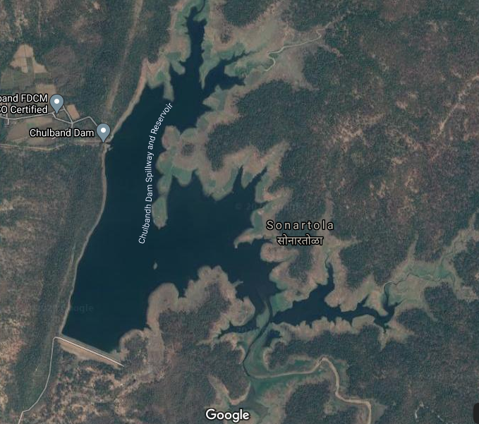
Map & link uploaded Aug- Sept 2020.
For viewing the surrounding areas and the map page click HERE.
Some information about Chulbandh Irrigation ProjectChulbandh Medium Irrigation Projectt was approved by Planning Commission Of India as a Medium Irrigation Project in Maharashtre State in year 1973..Project has two components , one Chulbandh Project Number D 01361 , and the other Lower Chulbandh Project Number JI 00580. Status and details about Lower Chulbandh Project Number JI 00580 are not available. Here description given is for Chulbandh Project number D 01361. Chulandh Dam was constructed in 1974 on Chulbandh River near Gondia in Gondia District of Maharashtra . The dam is an Earth fill dam . The length of dam is 465 m ( 1526 ft ) while the height of the dam above lowest foundation is 16.62 m ( 54.5 ft ) .Project has a Spillway of other type.Length of the spillway is not available.spillway is ungated.It has catchment area of 5.594 thousand hectors. Maximum storage capacity is 21.458 MCM. Live storage capacity is 16.54 MCM. Now a days almost all the water bodies make for good picnic spots.
(Note : Blue area in normal map corresponds to Maximum / Full Reservoir Level.)
Its amazing place for fun silent water waves of dams feels relaxing mode of my mood I feel very good to visit to place again and again.
ReplyDeleteItiadoh Dam